City Tour Course
Distance:
13.7km
Elevation Uphill:
36m
Elevation Downhill:
43m
Maximum Elevation Difference:
ー
This course starts from Taman Makam Pahlawan (Heroes’ Cemetery) Wisma Raga Satria (infront of Bupati’s Office) and finishes at the same place
Recommended Spots View spot Plants & Animals Gourmet Shopping Roadside station Hot spring Lodging Hospital Rent-a-cycle Bicycle dealers Cycling Support Toilet Other
※The website "Route Lab", which allows you to view cycling routes on an online map, ended its service at the end of March 2020, so due to the change to "Bikemap", there may be errors in distances and height differences on Bikemap. However, we appreciate your understanding and understanding.
Spots around the course
Filter by
All
Recommended Spots
View spot
Plants & Animals
Lodging
Taman Makam Pahlawan Wisma Raga Satria
Heroes’ Cemetery (infront of Bupati Office/Kantor Bupati)
Address:Jl. A. Yani, Tukangkayu, Kec. Banyuwangi, Kabupaten Banyuwangi, Jawa Timur 68416, Indonesia
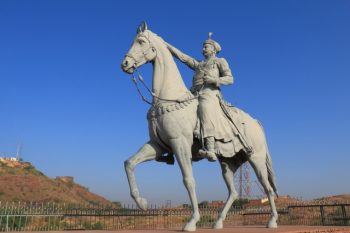
Patung Kuda
Address:Taman Tirta Wangi (horse statue), Jl. Letjen S Parman No.26, Sobo, Banyuwangi Sub-District, Banyuwangi Regency, East Java 68418, Indonesia
Santika Hotel
One of 3 stars hotel in Banyuwangi
Address:Jl. Letjen S Parman No.15, Sobo, Kec. Banyuwangi, Kabupaten Banyuwangi, Jawa Timur 68418, Indonesia
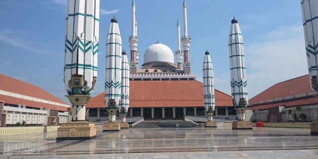
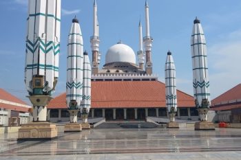
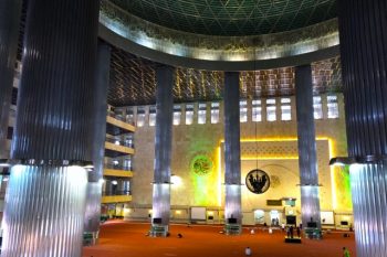
Baiturrahman Mosque
the place where muslim people pray. It is a huge place with special interior and exterior design with a nice green color dominated the look.
Address:Jl. Jend. Sudirman No.137, RT.003/RW.001, Kepatihan, Kec. Banyuwangi, Kabupaten Banyuwangi, Jawa Timur 68411, Indonesia
Sri Tanjung Park
This park is located in one complex with Baiturrahman Mosque, Pendopo Sabha Swagata Blambangan, and also near with Srengenge Wetan Restaurant
Address:Q9RF+288, Kepatihan, Banyuwangi Sub-District, Banyuwangi Regency, East Java 68411, Indonesia
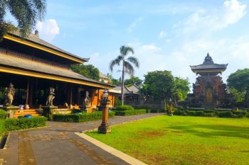
Pendopo Sabha Swagata Blambangan
the official’s house of Bupati
Address:Q9RF+MHH, Temenggungan, Banyuwangi Sub-District, Banyuwangi Regency, East Java 68412, Indonesia
Return to top of "Spots around the course"