There are several low “mountains” in Osaka City that are marked on topographical maps by the Geographical Survey Institute.
Among them, there are “Osaka Five Low Mountains,” and each of which is less than 30m above sea level, such as ancient burial mounds and artificial mountains. Here we introduce a cycling tour around the mountains of Osaka City, also called the “Osaka Alps,” including the Five Low Mountains.
Contents
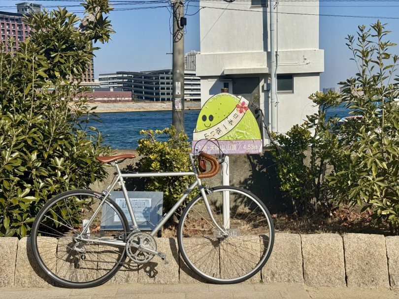
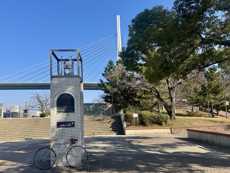
Tempozan (Minato-ku)
The tour starts at Tempozan Park near Osaka Port Station on the Osaka Metro Line.
You can ride to Osaka Port Station by bicycle from any major Osaka Metro station, and since it is less than 10km from Osaka Station or Namba Station by bicycle, Tempozan Park is a convenient place to meet up.
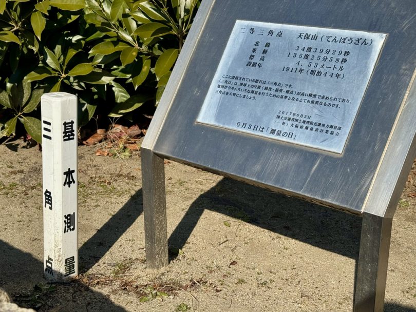
Tempozan is a mountain artificially created during the Tempo era (1830-1844) of the Edo period, with an elevation of 4.53m.
Although “mountain” has various definitions, it became famous as the lowest mountain in Japan at that time when it was included on the topographical maps of the Geographical Survey Institute.
It is said that the “Osaka Five Low Mountains Traverse Guide” published around 2002 by the Tempozan Mountaineering Club, which issued climbing certificates for this mountain, was the beginning of what is now known as the “Osaka Five Low Mountains.”
Today, Hiyoriyama (Sendai City, Miyagi Prefecture), of which elevation was lowered by the tsunami and land subsidence following the Great East Japan Earthquake in 2011, and of which elevation was confirmed to be 3m by a subsequent survey conducted by the Geographical Survey Institute, is the lowest mountain in Japan, and Tempozan is the second lowest mountain.
However, as a mountain with a second class triangulation point, it is still the lowest mountain in Japan. It is also interesting that you can ride a bicycle to the top of the mountain.

Showazan (Taisho Ward)
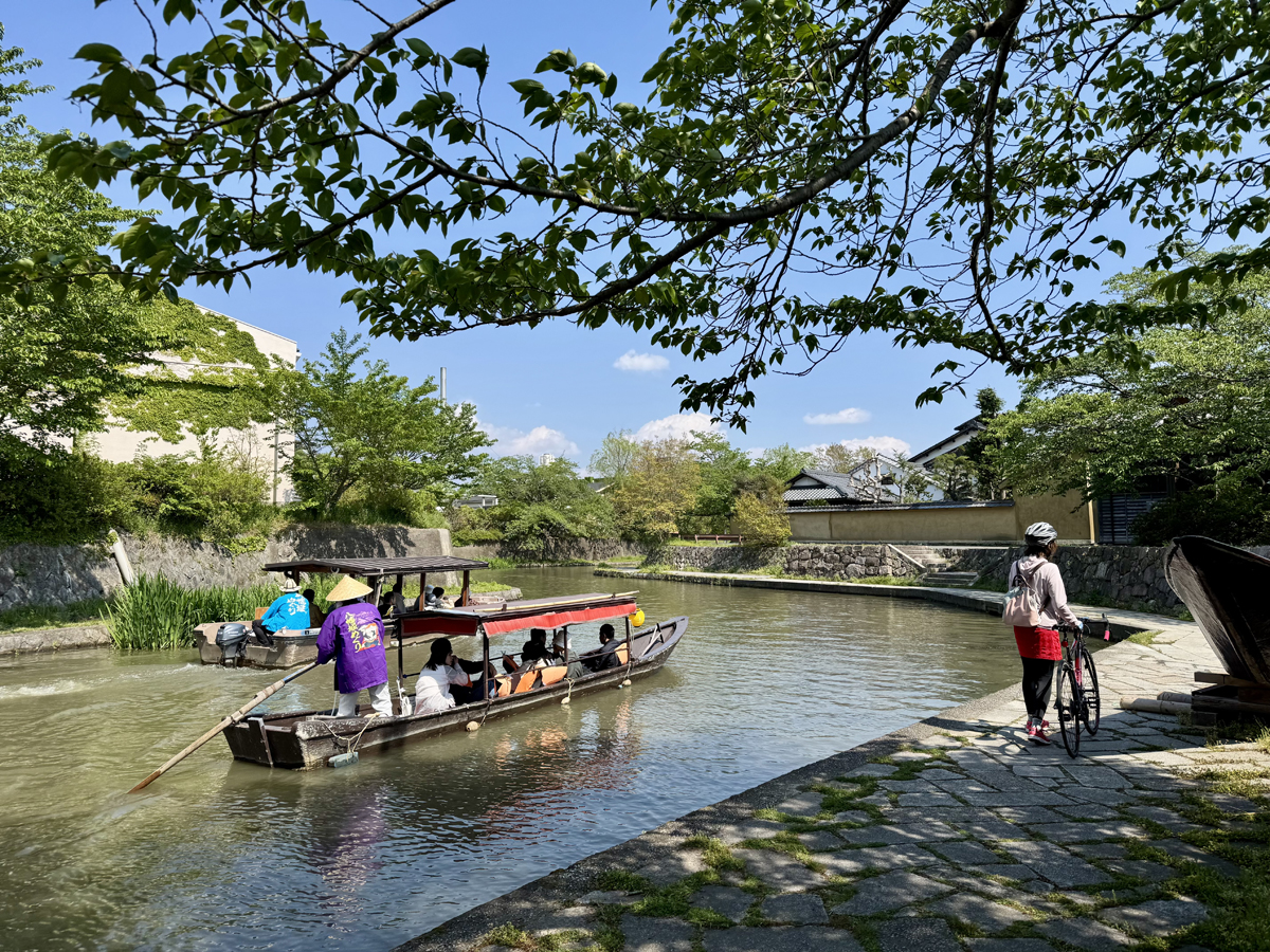
In the waterfront area of Osaka City, where there are many rivers and canals, there are still several ferry crossings. First, cross the Shirinashi River at “Jinbei Watashi” and head west via Showazan (Mt. Showa).

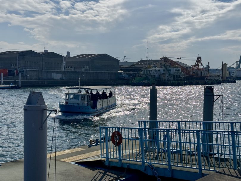
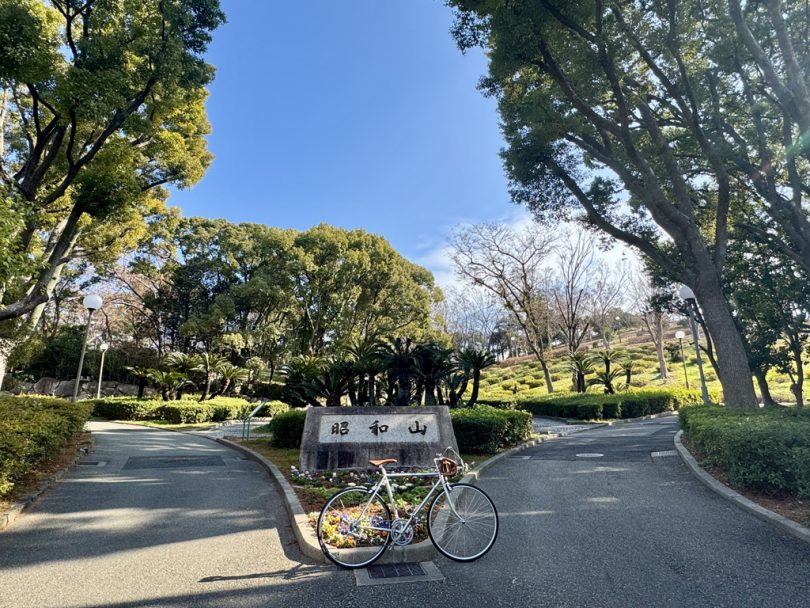
The populated mountain, which was built on the site of a former lumberyard and a park as “Harbor View Hill,” was named “Showa-yama” (Mt. Showa) because it was constructed in the Showa period (1926-1989).
With an elevation of 33m, Mt. Showa was the highest mountain in Osaka City at that time. Today, it is the second highest mountain after Tsurumi Shinzan, which was built in Tsurumi Ryokuchi. Therefore, it is not included in the Osaka Five Low Mountains.
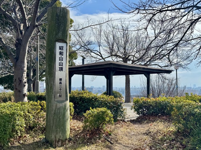
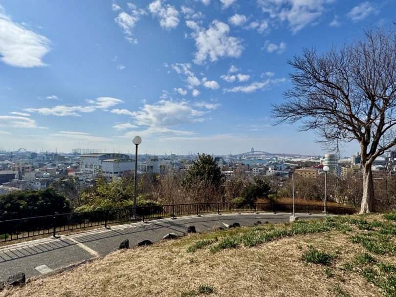
Since bicycles are not allowed in Chishima Park, where Mt. Showa is located, the summit is reached on foot. Indeed, there was a panoramic view of the harbor.
Tezukayama (Sumiyoshi Ward)
Crossing Kizu River from Mt. Showa by the Ochiai ferry, we pass through Nishinari Ward to Tezukayama in Sumiyoshi Ward.
Rather than a “mountain,” Tezukayama is known as one of the most exclusive residential areas in the Kansai region, and its name comes from “Tezukayama Kofun,” a burial mound.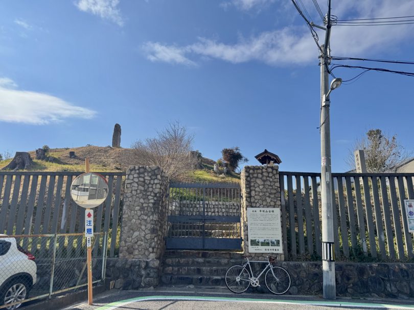
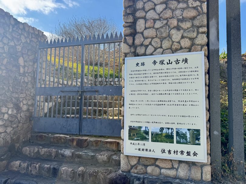
Tezukayama Kofun is 19.88 m above sea level (third class triangular point). It is a nationally designated historic site managed by a general foundation and is not accessible to the public.
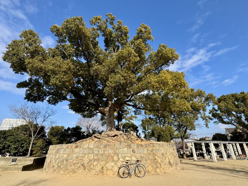
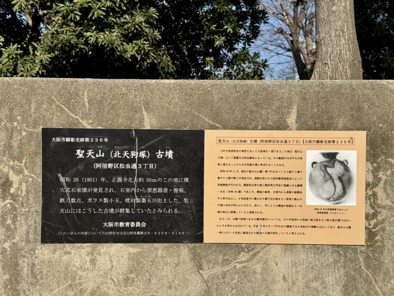
Shotenzan(Abeno Ward)
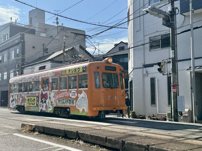
From the Tezukayama burial mound, ride 2km north on the streetcar portion of the Hankai Railway to Shotenzan.
Shotenzan (Mt. Shoten) is 14m above sea level; it is an ancient burial mound called Shotenzan Kofun, and the northern side is maintained as Shotenzan Park.
Also known as “Seitenzan Shoenji Temple,” the summit of the mountain is within the precincts of Shoenji Temple.
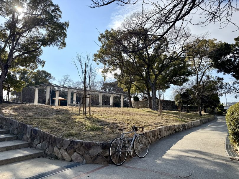
Okachiyama (Ikuno Ward)
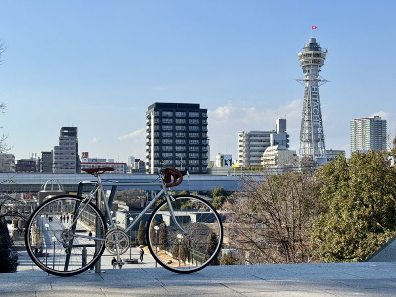
If you ride north along Abeno-suji Avenue from Shotenzan, you will see Abeno Harukas, which was once the tallest building in Japan at 300m.
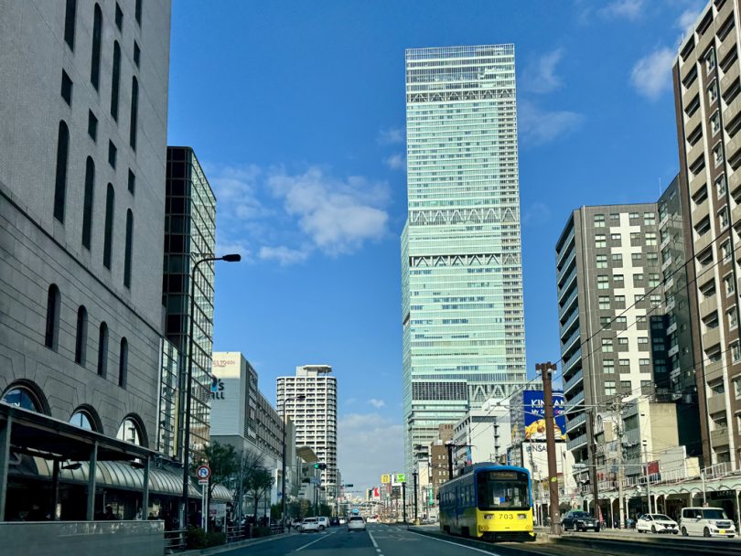
Completed in 2014, Abeno Harukas surpassed Yokohama Landmark Tower (296m tall) during construction in 2012 to become the “tallest building in Japan.” It is currently the second tallest building after Azabudai Hills Mori JP Tower (325m tall), which will open in 2023.
After passing Abeno Harukas, ride east to Okachiyama (Mt. Okachi).
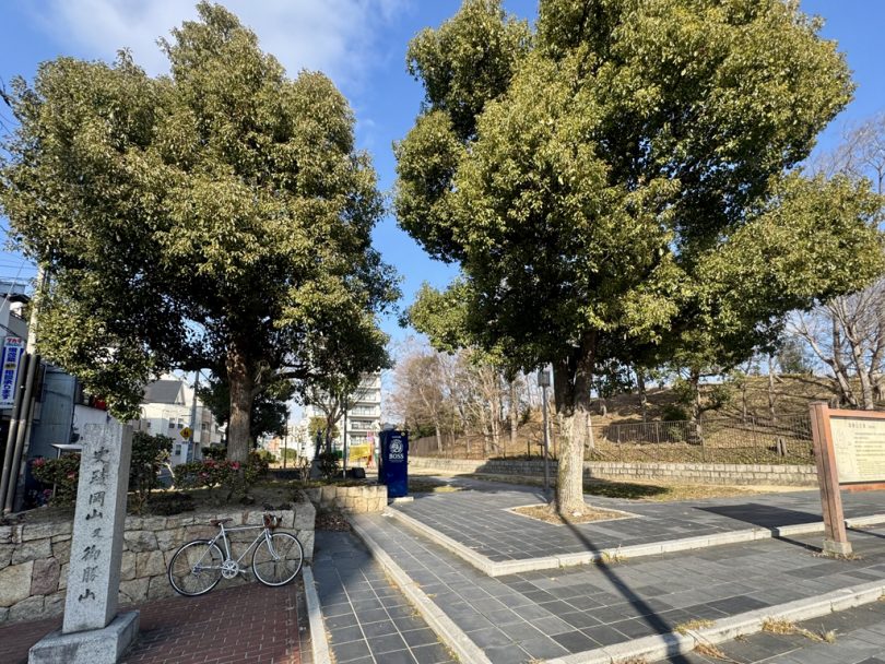
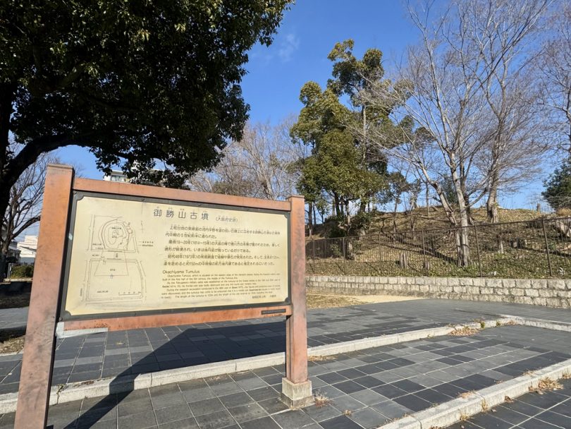
Okachiyama burial mound is in the Okachiyama Park, and is 14m high according to the elevation point of the Geographical Survey Institute (13.25m high according to the signboard in the park).
Originally named “Okayama” or “Maruyama,” it is now called “Okachiyama” after the victory of Hidetada Tokugawa in the Winter and Summer Siege of Osaka.
Chausuyama (Tennoji Ward)
Cycling again to Tennoji, where Abeno Harukas is located, we will go to Chausuyama (Mt. Chausu) in the Tennoji Park area.
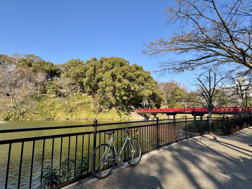
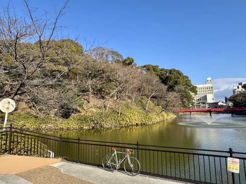
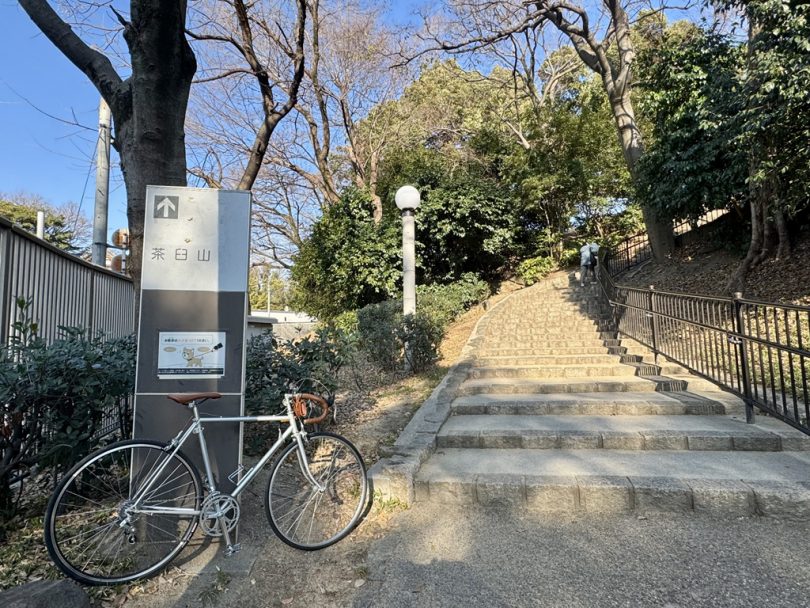
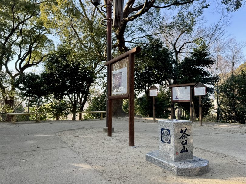
TheChausuyama burial mound is 26m above sea level, can be reached on foot from the park.
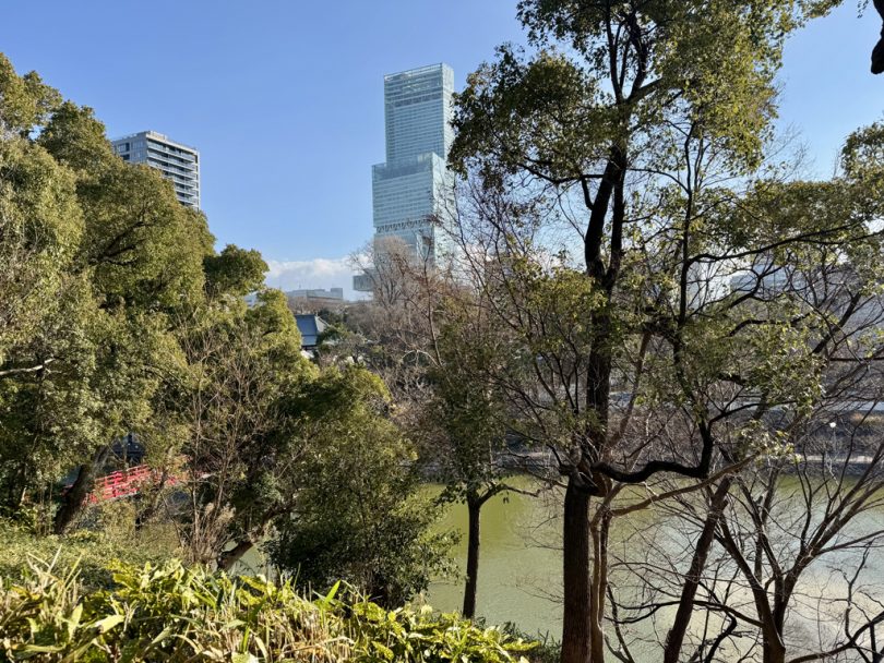
From the top of the mountain, you can see not only Tennoji Park, including Kawazokoike Pond, but also look up at the 300-meter-high Abeno Harukas.
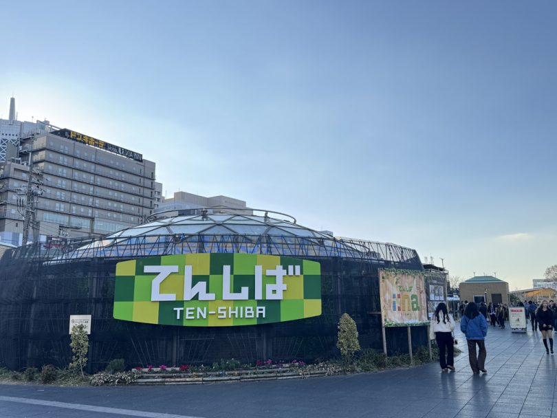
Tennozhiba and Abeno Yokocho
Not only are there cafés and restaurants in Tennoji Park entrance area “Tenshiba”, but there are also many commercial complexes and underground shopping malls including Abeno Harukas around Tennoji Station where JR and Osaka Metro lines intersect.
After cycling, you can park your bicycle at the bicycle parking lot and spend your time at a stylish restaurant, or go to “Abeno Yokocho,” an underground shopping mall that retains the Showa period (1926-1989) atmosphere.
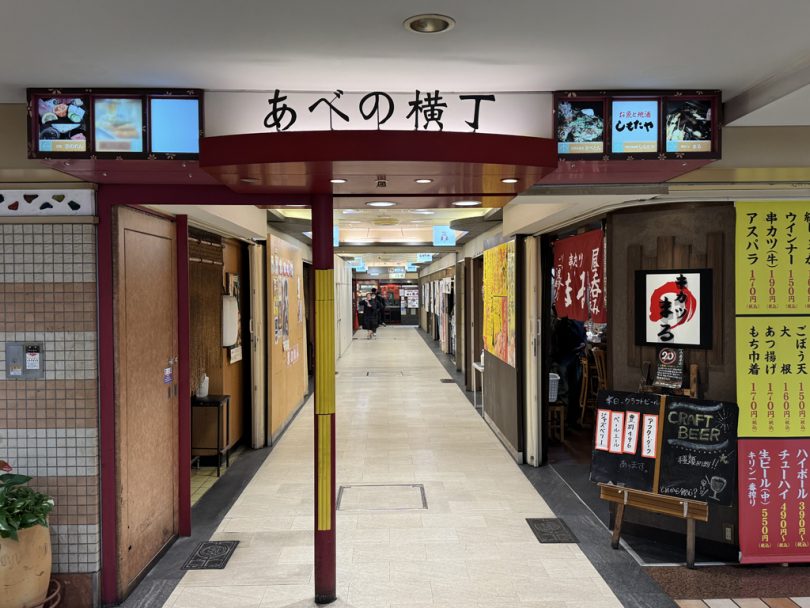
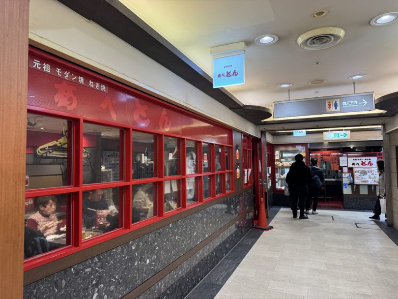
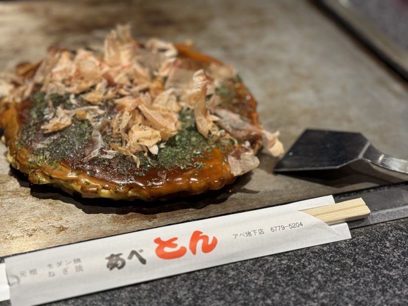
Osaka is famous for “konamon,” or flower based food. Enjoy okonomiyaki at Abeton and finish your cycling.
Course Introduction
Distance:24.9km Altitude gain:92m (walk included)
Summary
The five low mountains of Osaka are 78.41m high in total, 111m in total adding up the second highest mountain in the city, Showa Mountain. Calling them the “Osaka Alps” shows Osaka’s unique sense of humor.
We hope you will enjoy the “Five Low Mountains Tour,” that takes you on a tour of Osaka’s famous landmarks and ferry boats.
Text/Photo: Yasushi Hanada