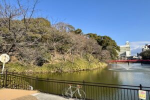
Mitake Shosenkyo Gorge, designated as a special national scenic beauty spot, is popular for its beautiful autumn colors. The promenade along the valley is one-way on weekdays only, but is open to vehicles and bicycles.
Contents
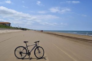
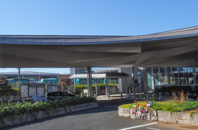
Start from Ryuo Station
The starting point is Ryuo Station, located next to Kofu Station on JR Chuo Line.
The route from Kofu Station to Shosenkyo Gorge is hilly, so we chose Ryuo Station because of its relatively gentle slope. The rotary in front of the station is wide, and we recommend that you can take your time to prepare for your bike ride.
To Shosenkyo with a view of Mt.Fuji
Take the north exit of Ryuo Station and go straight north after joining Prefectural Route 25.
At first, you will be riding through the town, so be careful of cars.
From “Nishimachi” intersection, the road becomes Prefectural Route 101, which is wider and easier to ride.
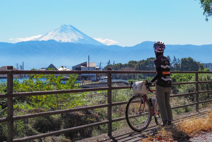
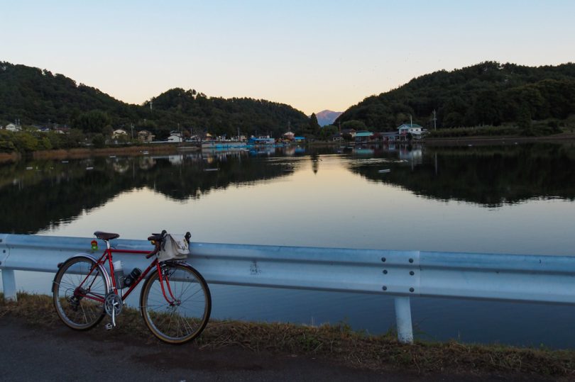
When you see a large blue sign with the words “Shosenkyo” before Kaneishi Bridge, turn right and cross the bridge.
From Kaneshi Bridge, you can get a beautiful view of Mt Fuji.
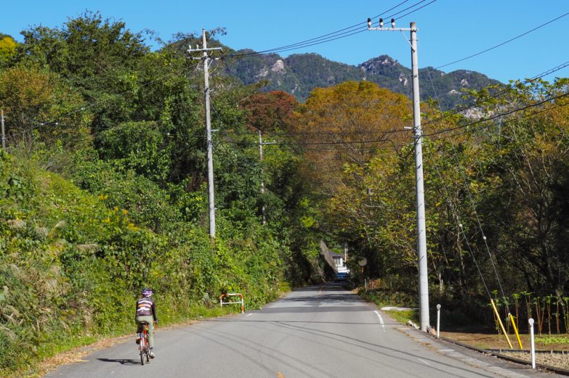
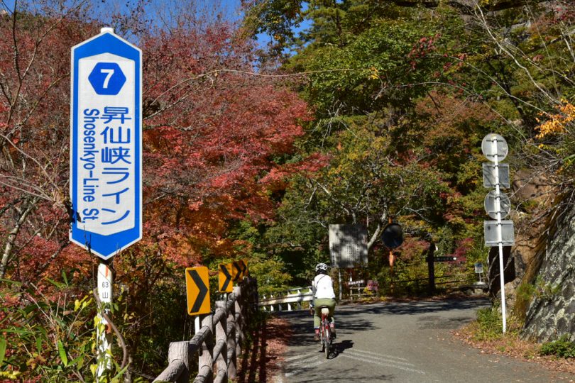
Prefectural Route 7 is named Shosenkyo Green Line, and is said to be a popular hill-climb route for local cyclists.
However, the slope is not that steep, so we proceeded on a leisurely ride.
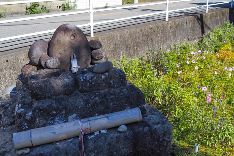
Round Stone Dosojin in Yamanashi Prefecture
There are various Dosojin throughout Japan, but the characteristic and mysterious feature of Dosojin in Yamanashi Prefecture is that many of them are enshrined with round stones. The reason for this is not clear, but the fact that there are more than 700 round stone Dosojin shrines in Yamanashi Prefecture indicates that people have believed in them for a long time.
There is also a Maruishi (round stone) Dosojin along the route. It is fun to pay attention to them when you ride through Yamanashi Prefecture.
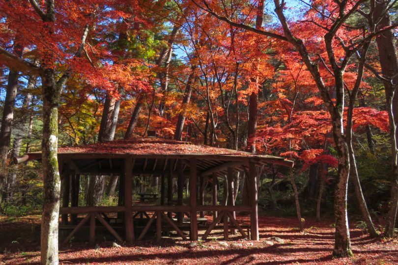
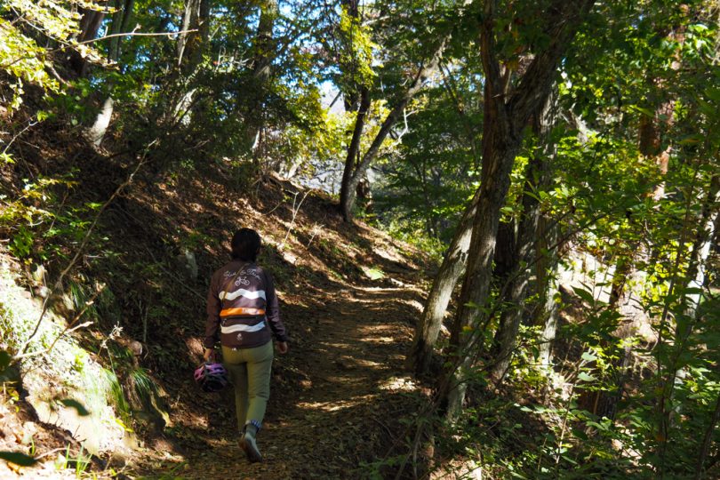
Riding along the valley of Shosenkyo Gorge
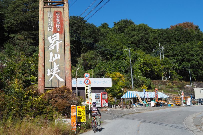
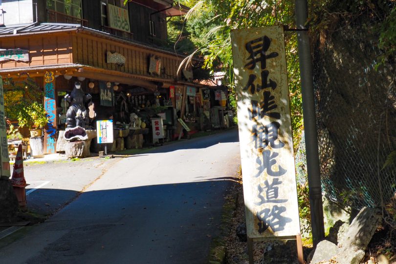
When you see the large Shosenkyo Gorge sign, you will feel the atmosphere of a tourist attraction with souvenir shops and other shops.
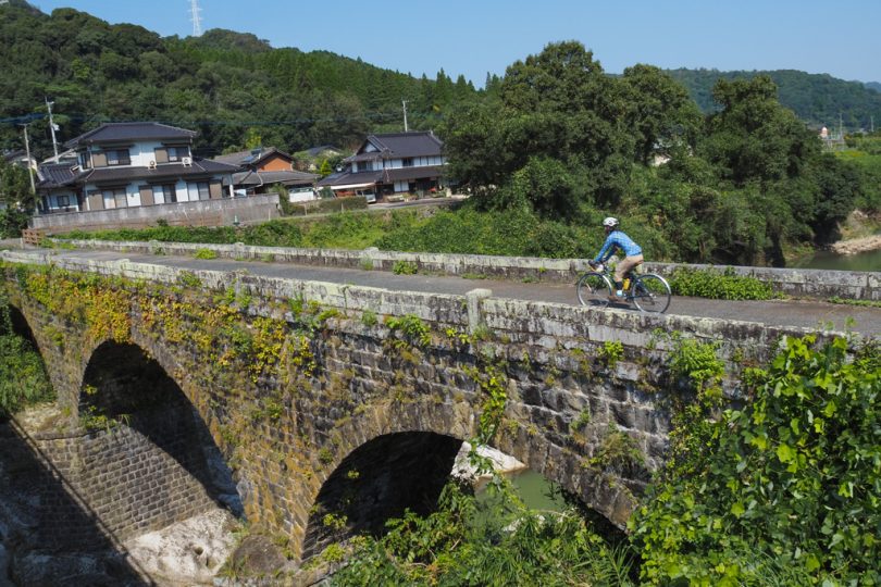
Nagatorobashi Bridge, built in 1925, is the oldest existing concrete arch bridge in Yamanashi Prefecture. The maple trees by the bridge were also beautiful.
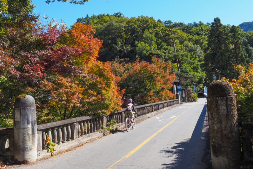
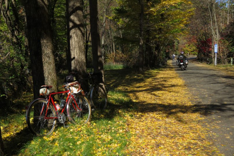
After crossing the bridge, you will enter Shosenkyo Line, which runs along the valley on the left.
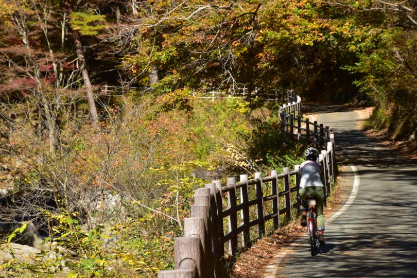
As indicated by the road sign, the road is closed to vehicles except for tourist carriages on Saturdays, Sundays, and holidays from May 1 to November 30. Therefore, if you want to ride a bicycle on the canyon road, you must do so only on weekdays.
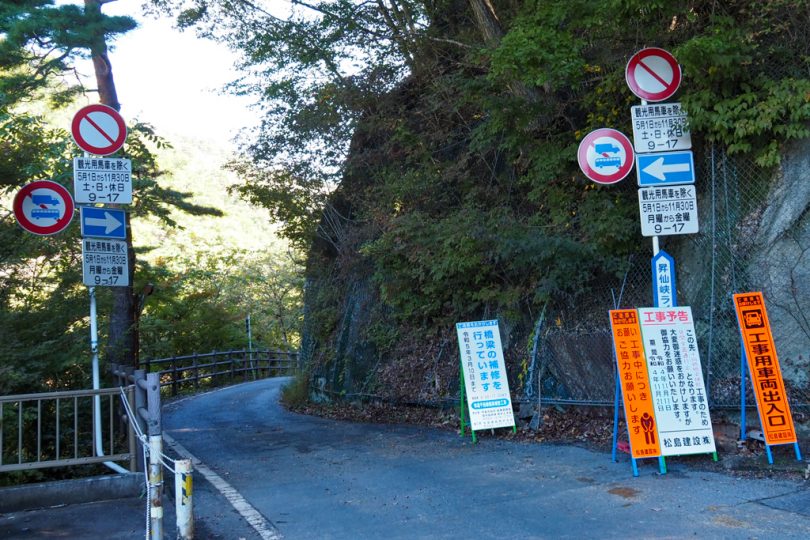
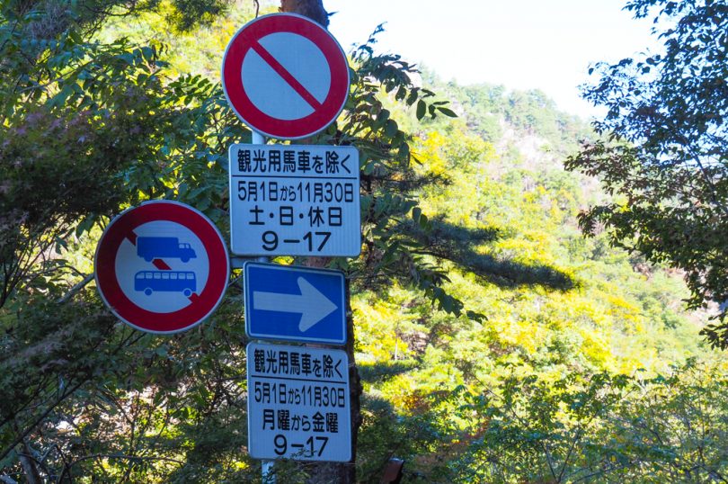
Even on weekdays, there are many tourists on foot, so please ride with caution.
It is a one-way street, so riding in the wrong direction is also prohibited.
Let’s enjoy the art of nature!
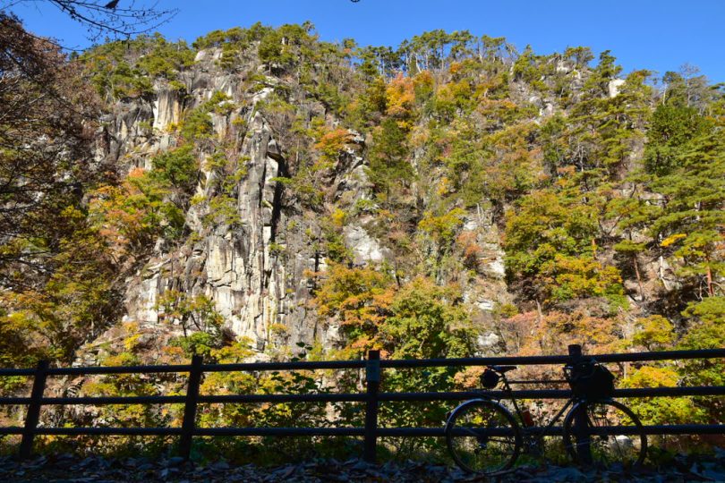
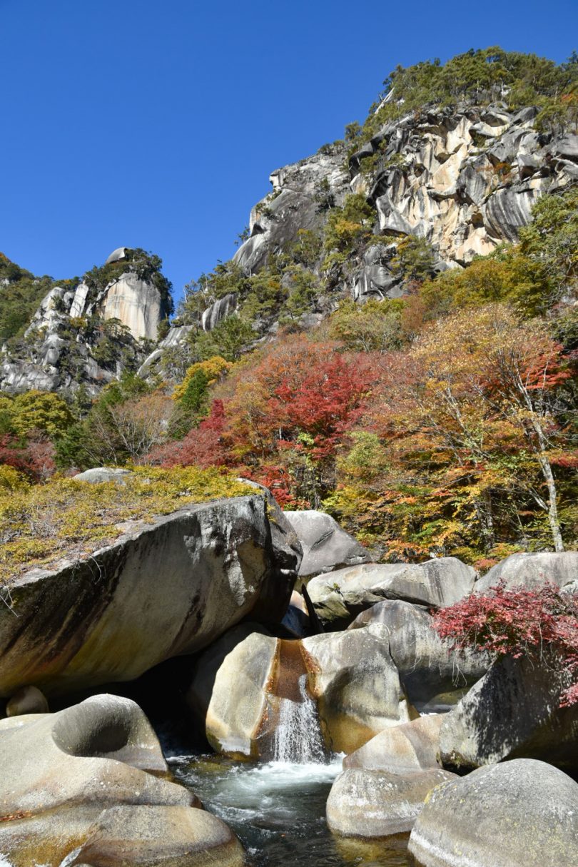
Shosenkyo Trail is a beautifully scenic path that was selected as “No. 1 in the ravine category of the 100 best sightseeing spots in Japan”.
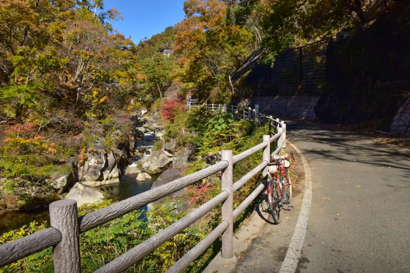
Check out the oddly shaped rocks formed when the river eroded the granite, each of which has a name.
Some of them make you think, “Which one?” while others are named “I see”.
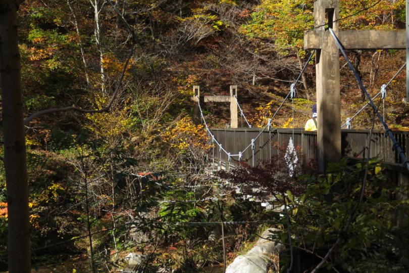
There are several bridges along the way that cross over to the other side of the river.
The view of the valley and autumn leaves from the suspension bridge named “Ai no Kakebashi” (The bridge of love) is also beautiful.
At the halfway point of the canyon road, the ground of Tenkorin (Heavenly Drum Forest) has been carved by the mountain stream over a long period of time, creating an underground cavity.
The name “Tenkorin” comes from the sound you hear when you step on the ground.
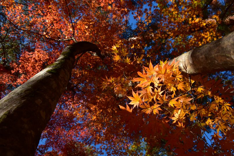
After Tenkrin, there are fewer oddly shaped rocks, but you can enjoy the autumn leaves along the trail.
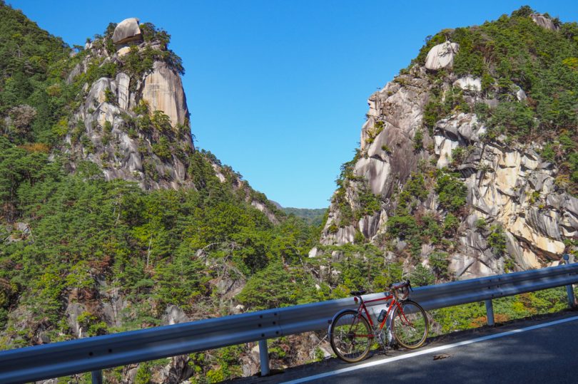
Kakuenbou Peak and Yume-no-Matsushima
From the junction where the road joins Shosenkyo Green Line, it becomes the “Shosenkyo Sightseeing Road”.
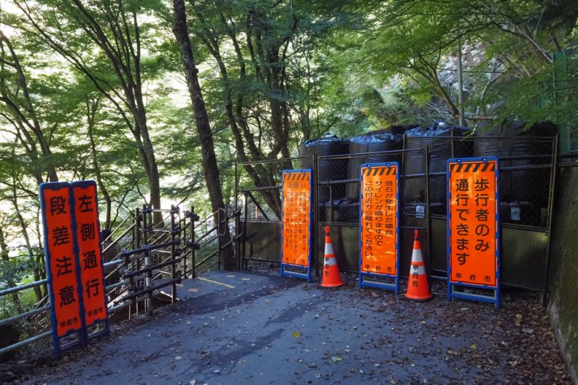
This road used to be accessible by bicycle, but is now closed to vehicular traffic due to the rock fall that occurred at Yume-no-Matsushima.
Since the road turns back at Yume-no-Matsushima, stop your bicycle and go on foot.
As you walk, you will gradually see Kakuenbou.
When you arrive at “Yume-no-Matsushima”, sandbags are piled up and the road is completely impassable. You will pass through a temporary detour route that has been set up temporarily since last month.
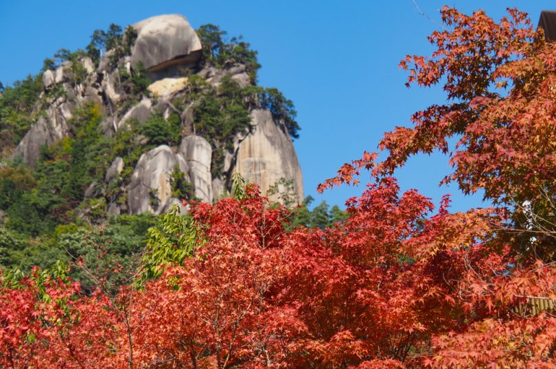
From Yume-no-Matsushima, the 180m high Kakuenbou Peak rises in front of you and is a powerful sight.
Riding Shosenkyo Green Line
After returning to your bicycle, head from the valley road to Shosenkyo Green Line on Prefectural Route 7.
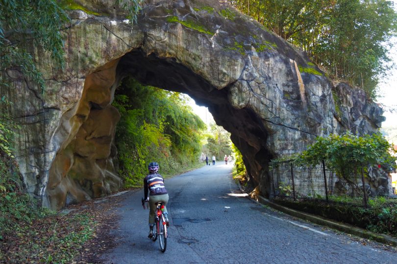
Pass through an unexcavated tunnel and turn left at the crossroads.
Be careful on Shosenkyo Green Line as there are many sightseeing cars and buses.
There are several tunnels, so be sure to keep your lights on.
You can also enjoy the spectacular view of Kakuenbou from this road.
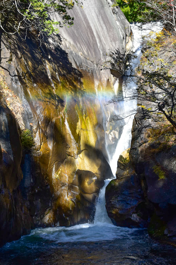
Sengataki Falls with a drop of 30m
After passing through the tunnel and crossing a narrow bridge, you will come to the entrance of Sengataki Falls.
Continue along the road lined with souvenir shops and descend the stairs until the waterfall appears before your eyes. The waterfall is selected as one of the “100 Best Waterfalls in Japan” and is well worth seeing as it cascades down the granite.
Edible Crystal Ball
At Sennin Chaya (Hermit tea house) in upper area, a popular menu item is “Edible Crystal Ball,” which is available only in Shosenkyo.
The transparent jelly is topped with soybean flour and molasses.
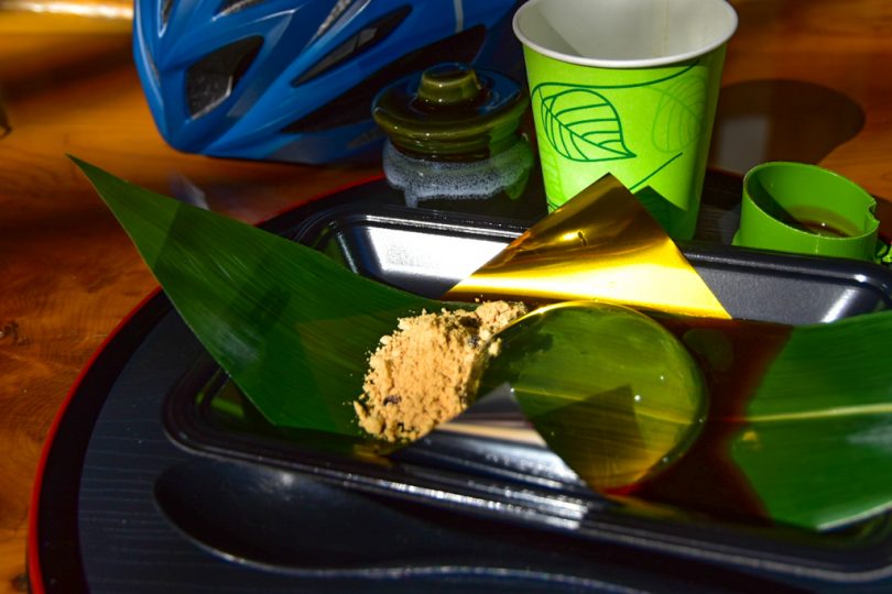
The jelly, which is surprisingly elastic, is cold, slippery, and delicious.
Ropeway to the summit
Park your bicycle by the parking lot and take Shosenkyo ropeway to the summit.
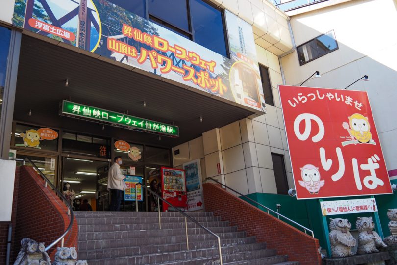
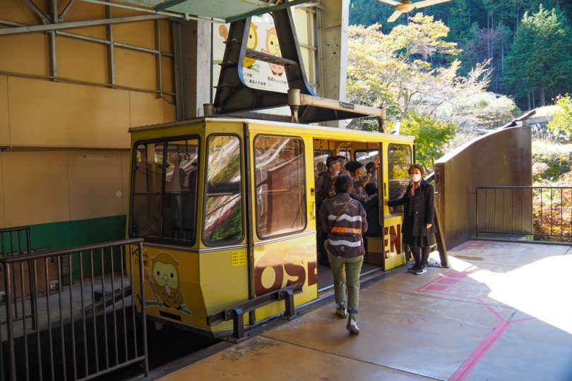
It takes about 5 minutes to ascend the 300m elevation gain all the way to the top.
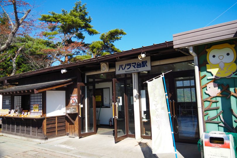
At “Panorama-dai Station” at the top of the mountain, there is a well-maintained observation deck called “Ukifushi Plaza” where you can get a beautiful view of Mt Fuji.
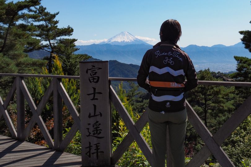
Mt.Fuji from here is also beautiful, but we will extend our walk a little and head for Mt Yasaburo.
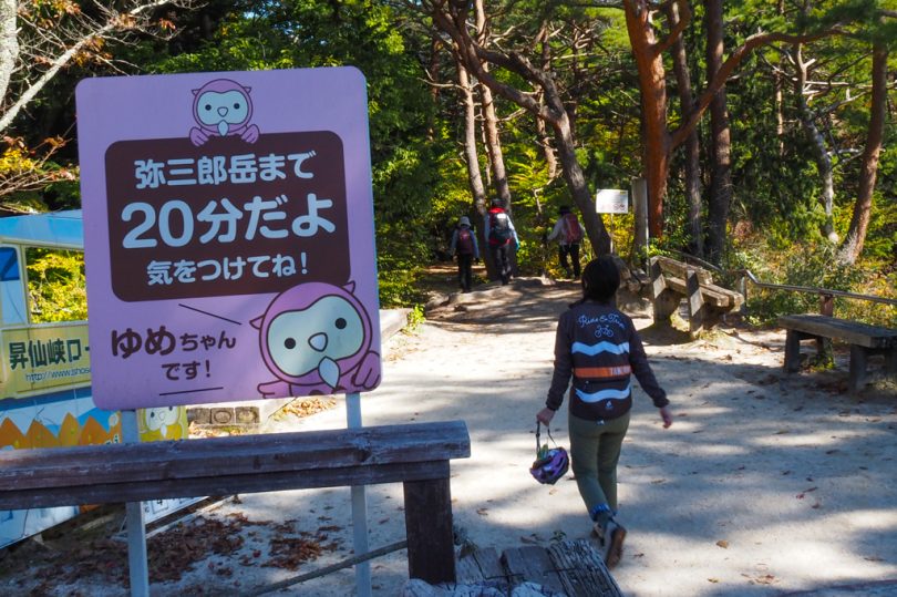
It takes about 20 minutes on foot to Mt Yasaburo. The road becomes a mountain trail, so it is recommended to wear comfortable walking shoes.
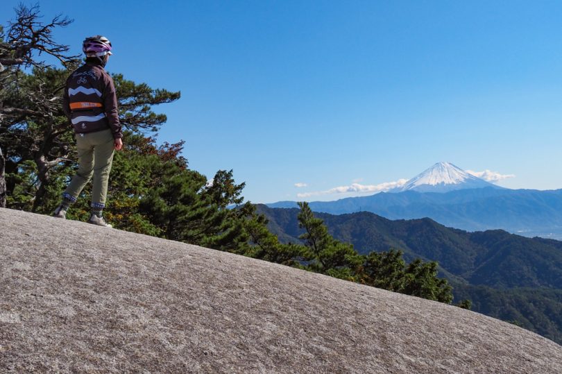
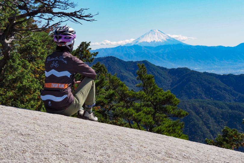
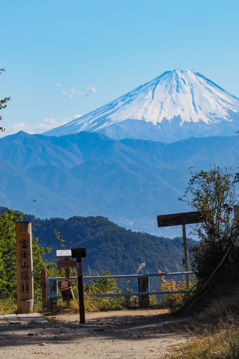
Mt. Fuji seen from the top of a round stone
The path gradually becomes steeper and steeper, and at the end you climb along a rock chain to reach the top of the monolith.
The granite monolith is rounded, so watch your step.
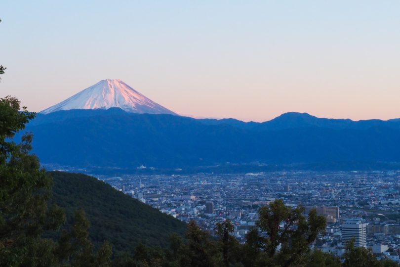
In front of you, you can enjoy a 360-degree panorama of Kofu Basin and Mt Fuji.
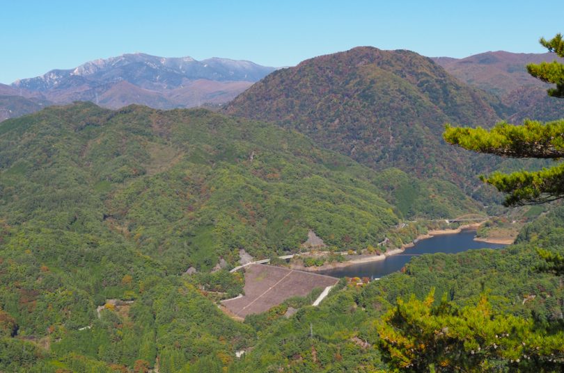
On the other side of Mt. Fuji, you can see Arakawa Dam, which we will visit later.
Beyond that, Mt. Kinposan peeks out from its white peak.
Mt.Fuji from the rocks is exceptional, but I was a little nervous because there is no fence.
Among varieties of Mt.Fuji view spots,, I recommend this one for its unique atmosphere.
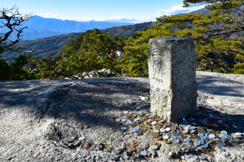
The next rocky area is the summit of Mt Yasaburo.
There was a pile of money that everyone had left for the summit.
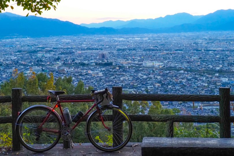
Returning to Panorama-dai Station and continuing on, you will come to a place called “Uguisudani.
Unlike Mt. Yasaburo, the path here is easy to walk and you can enjoy the spectacular view.
Houtou-nabe when you come to Yamanashi Prefecture
Dropping off the ropeway, it’s time for lunch.
I asked the ropeway attendant, “Where is the best place for houtou-nabe?”
I headed for “Hashimoto-ya” on her recommendation.
![]()
We were allowed to leave our bicycles in a place where we could see them from inside the restaurant, so we could eat in peace. The waitress was very kind.
The houtou nabe that came out looked delicious with a big chunk of ingredients.
The noodles were unevenly shaped, and it seems that the noodles are handmade by the restaurant.
The red miso sauce was very light and tasty.
![]()
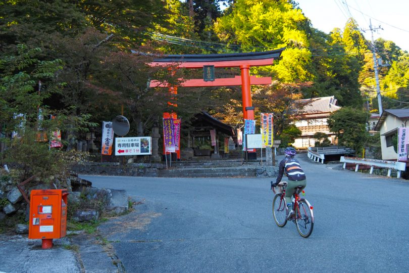
Petit Hill Climb to Kanazakura Shrine
After lunch, we will hill-climb about 2.5km to Kanazakura Shrine.
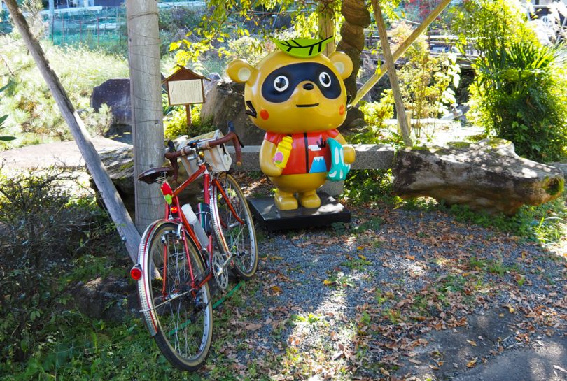
Before that, we greeted “Charitanu-kun” who is in Shosenkyo. He was in a slightly confusing place.
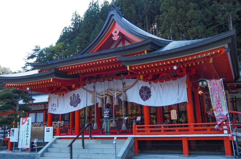
Kanazakura Shrine is a shrine of mountain worship with Mt Kinpo. There is a main shrine at the top of Mt Kinpo.
When you see the red torii gate, go up to the parking lot further ahead.
Leave your bicycle in the parking lot and head toward the shrine. You will be surprised to see a beautiful vermilion shrine pavilion deep in the mountains.
I heard that it is also famous for its cherry blossoms, so I would like to visit in the spring as well.
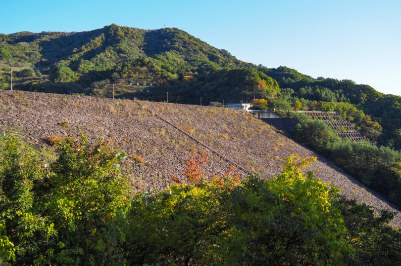
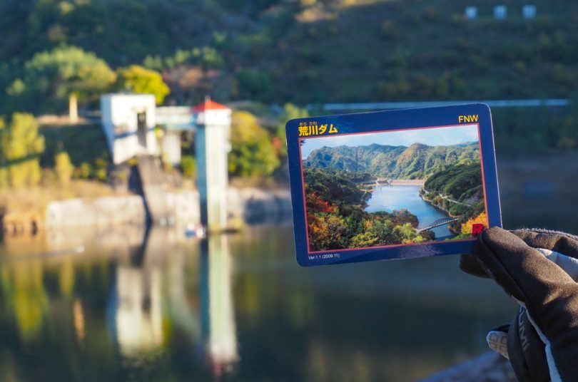
Let’s get a dam card at Arakawa Dam
Make a U-turn at Kanazakura Shrine, go down the hill, and stop by Arakawa Dam.
It is a rock-fill dam, and has an elegant atmosphere of being one with nature.
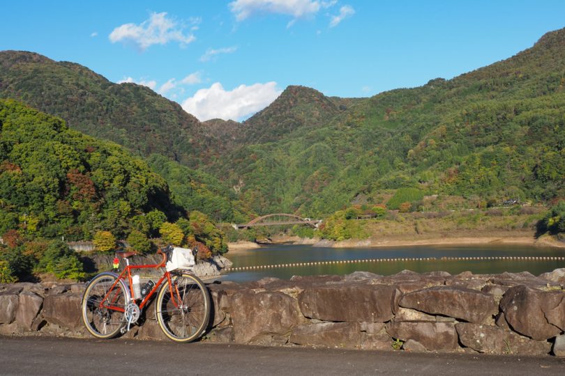
We went to the administration building and got a dam card. From here, you can go around the dam or just turn around.
Go down Shosenkyo Green Line and turn right before Chiyoda Lake.
Please note that it is a narrow road and difficult to find.
Mt.Fuji from Miharashi Hiroba
When you proceed in the direction of Yamanashi Takeda-no-Mori from Lake Chiyoda, you will stop by Miharashi Hiroba.
I recommend stopping there, since from where you can see the cityscape of Kofu and Mt Fuji.
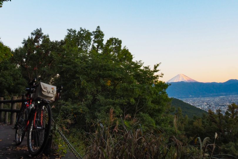
Mt.Fuji for a moment due to overgrowth of trees, but if you go down the stairs on the right, you can see it perfectly.
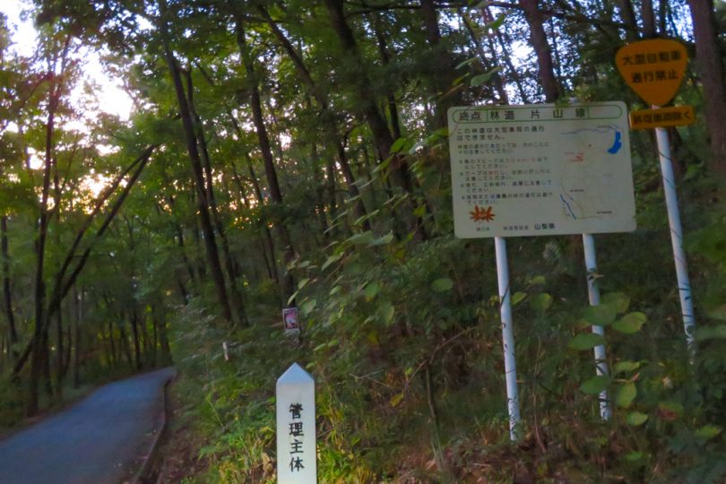
To Ryuo Station via Forest Road Katayama Line
It has become dim, but we entered the forest road Katayama line from the middle of the hill.
If it had been a little brighter, we might have been able to enjoy the greenery and autumn leaves, but dusk falls early in autumn.
After descending the forest road, you will reach the city center. The rest of the route to Ryuo Station is the same as the one we took at the beginning, and it is the end of the tour.
Course Introduction
Access
Train: Take JR Chuo Line from Shinjuku Station to Ryuo Station.
By Car: 15 minutes from Kofu Showa Interchange on the Chuo Expressway.
▼Shosenkyo
https://www.shosenkyo-kankoukyokai.com/en/
▼Shosenkyo Ropeway
http://www.shousenkyo-r.jp/
Summary
This is a course that you should try on weekdays when you can drive along the valley road of Shosenkyo where the autumn leaves are beautiful.
The best time to see the leaves is usually from mid-October to late November.