In order to enjoy the beautiful autumn foliage of “Iroha-zaka” and “Odashirogahara”, the starting point is the parking area around Kiyotaki Interchange on Nikko-Utsunomiya Road.
If you are heading there by train, the starting point will be Nikko Station on JR Nikko Line or Tobu Nikko Line, although the distance will be a little longer.
Contents
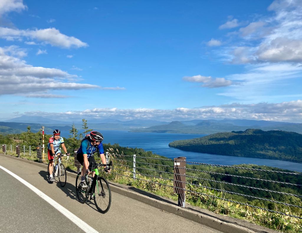
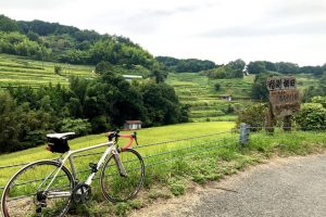
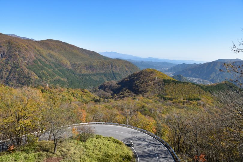
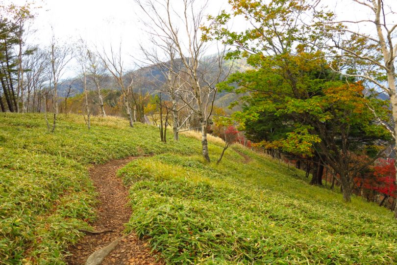
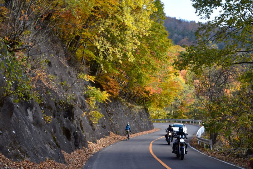
Going up “Second Iroha-zaka” with beautiful autumn leaves
Unlike the start from the station, we started from Kiyotaki Interchange area, so we had to start up “Iroha-zaka” (Iroha slope) without even warming up.
Even so, the beauty of the surrounding scenery made my steps feel lighter than usual.
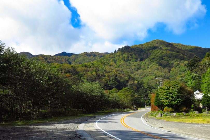
From Iroha-zaka Horseback Ride parking lot, “Iroha-zaka” is divided into uphill and downhill, and is one-way.
This is the last point where public restrooms are available before entering the hill.
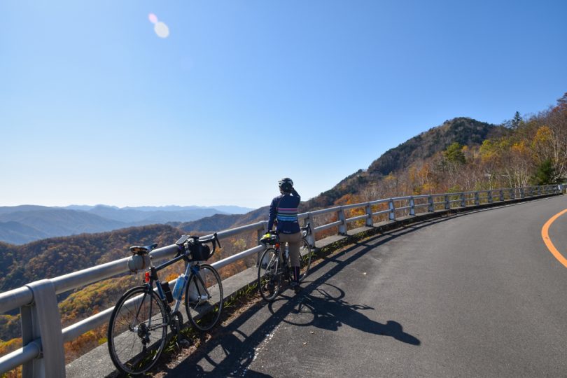
Entering the second Iroha-zaka (ascent), there is a point where you can see both Daiya river and Mt.Nantaisan.
Expectations are high for the autumn leaves, which will become darker as the elevation increases.
Pedal leisurely while watching out for cars.
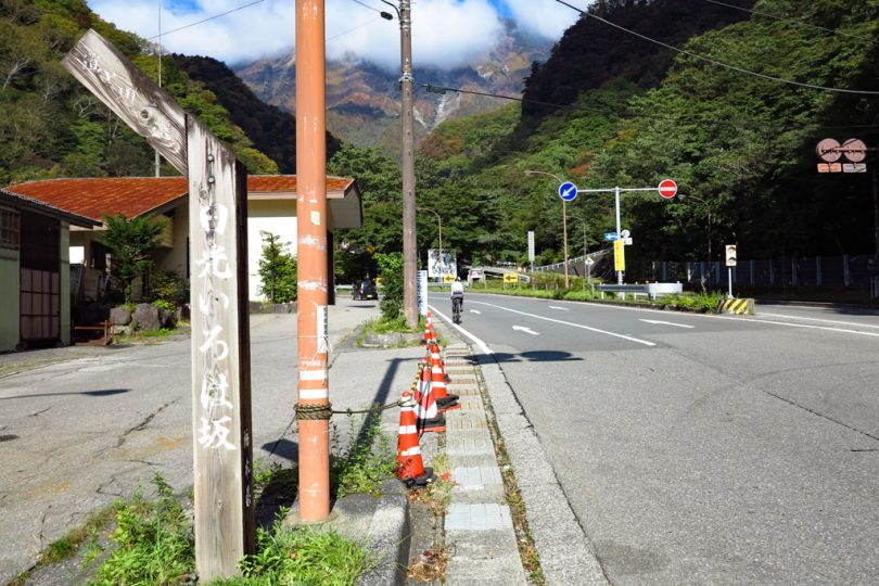
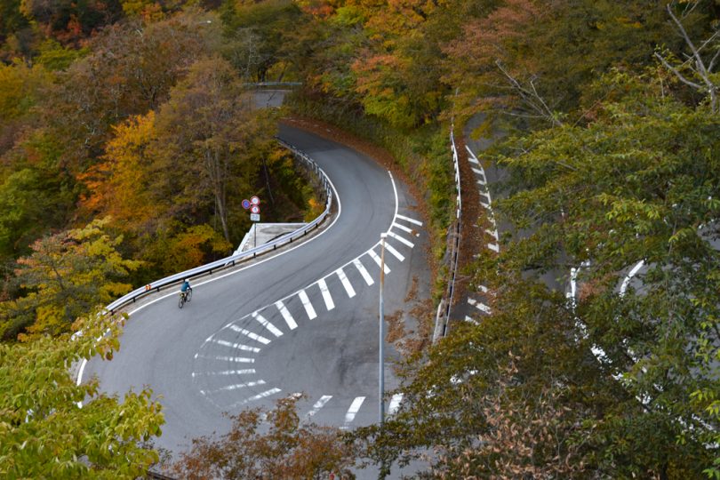
In the old days, there were a total of 48 curves in the two-way traffic, so it was named “Iroha-zaka” in reference to the “48 syllables of Iroha”.
After that, the curves were improved and divided into uphill and downhill only, and now the second Iroha-zaka has 20 curves from “I” to “Ne,” (the first 20 syllables) and the first Iroha-zaka (downhill slope) has 28 curves from “Na” to “N,”(the latter 28 syllables) for a total of 48 curves, which is called “Iroha-zaka”.
At first I was counting the number of curves as I went up, but I forgot as I was enjoying the scenery.
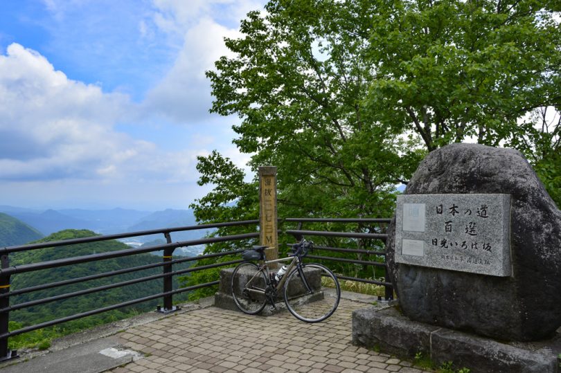
After a series of fine hairpins, between the large curves “Re” and “So,” Kurogamidaira Observatory appears. It is a small parking lot, but there is a stone monument that reads, “One of the 100 best roads in Japan”. The view from the observatory overlooks the winding road up to the top.
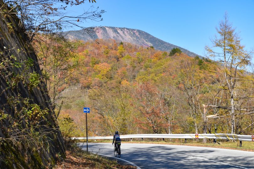
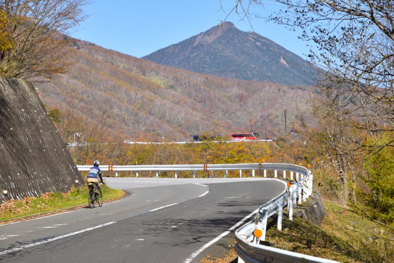
The autumn leaves are becoming brighter and brighter, and Mt. Nantai.
Even though the road is uphill only, there are many cars and motorcycles during the season of autumn leaves, so be careful.
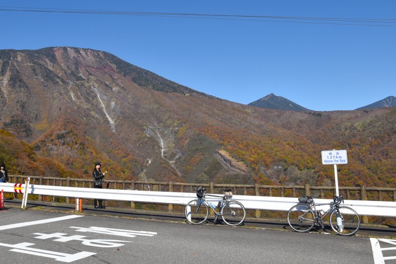
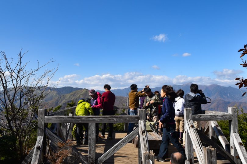
View from Akechidaira Ropeway Observation Deck
You will see a tourist bus parked at the end of the curve, and you are almost at Akechidaira Ropeway Observation Deck.
When you arrive at Akechidaira, which is 1,274 meters above sea level, you can take a nice break and enjoy the view from the ropeway and Mt.Nantai.
You can enjoy the bright red ropeway coming and going right in front of you.
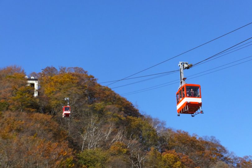
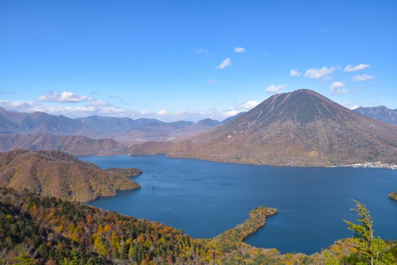
If you take the ropeway to the observatory, you will be able to see Nikko Kegon Falls.
We did not take the ropeway this time because we did not have enough time, but we would like to take it if we have a chance.
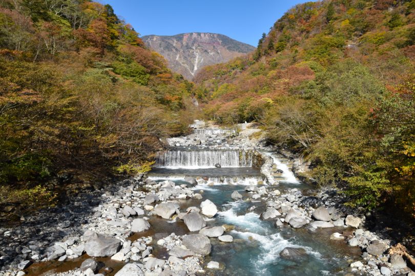
Hill Climb from Chuzenji Lake to Mt. Hangetsu
After passing through the Akechi No. 2 Tunnel and descending the hill, you will arrive at Chuzenji Lake. At this point, the temperature seems to have dropped considerably.
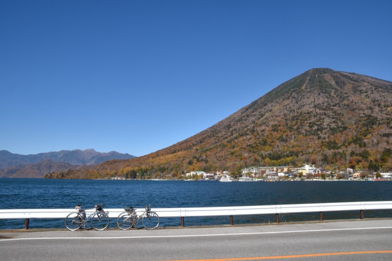
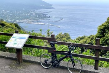
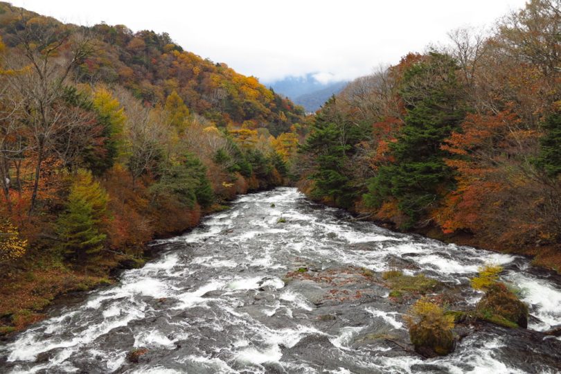
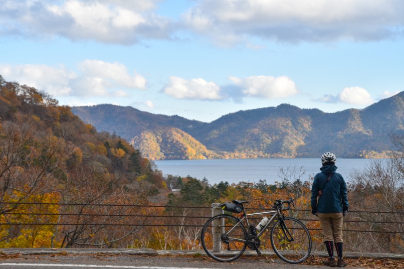
Passing by the British Embassy with Lake Chuzenji on your right, you will enter the 7-km climb of Lake Chuzenji Skyline.
Lake Chuzenji Skyline is not as busy as the “Iroha-zaka” and offers a good view of Lake Chuzenji on the way up.
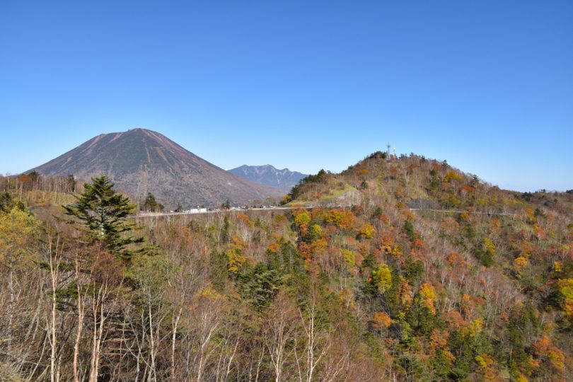
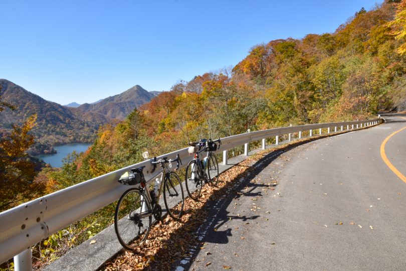
Petit Hike at Mt.Hangetsu
Chanokidaira Observatory and Lake Chuzenji Observatory are located in front of the parking lot, but since we plan to take a short hike at Mt.Hangetsu, we just pass them through.
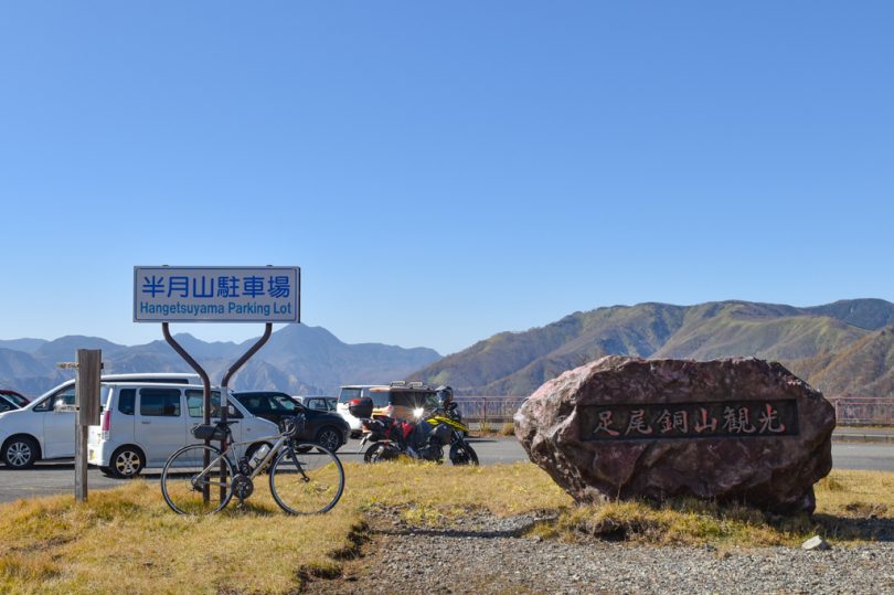
We are concerned about the impression that the road ends at the place where the large parking lot is located. We checked and found that the road was originally supposed to extend to Ashio side, but it seems that the construction ended at Mt. Hangetsu.
You can see the mountains on Ashio Copper Mine side from the parking lot.
The surface of the mountain on the Ashio Copper Mine side looks withered because of smoke pollution emitted from the refinery. Over the years since then, the greening of the forest restoration has progressed, and the area seems to be gradually recovering its greenness.
The road cut off at Mt. Hangetsu looks sad.
From here, we stopped our bicycles and started a 30-minute one-way petit hike.
We recommend wearing comfortable SPD shoes as it is a solid mountain path.
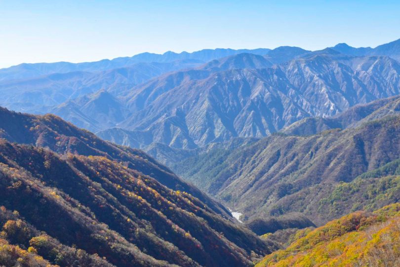
After climbing up the narrow mountain path, you will see a wooden observation deck.
You can see Lake Chuzenji from here.
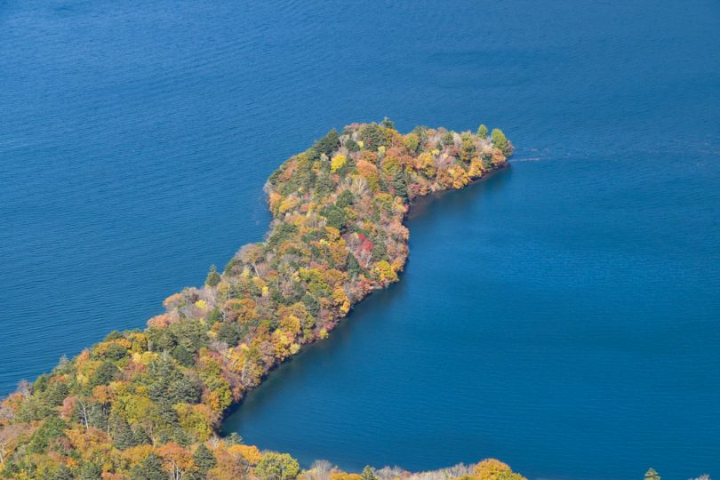
Haccho Desjima with beautiful gradation
When looking at Lake Chuzenji from Mt.Hangetsu Observatory, Haccho Desjima protruding into the lake stands out prominently.
During the fall foliage season, many visitors come to see the colorfully tinted Haccho Dejima.
After enjoying the spectacular view, go back the way you came and downhill to Lake Chuzenji.
The downhill is long, so if you are cold, you might want to bring more warm clothes.
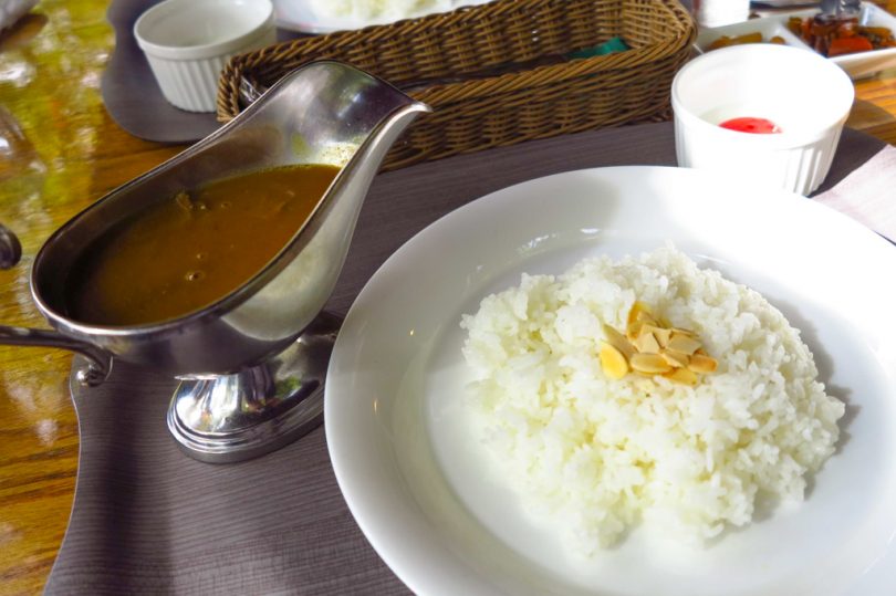
Centennial Rice Curry at a Long-established Hotel
After returning to Lake Chuzenji, we will have lunch.
Let’s have Hyakunen (Centennial) Rice Curry at Coffee House Yukon, a log house-style restaurant located at the entrance of Lake Chuzenji-Kanaya Hotel, a long-established hotel in Nikko.
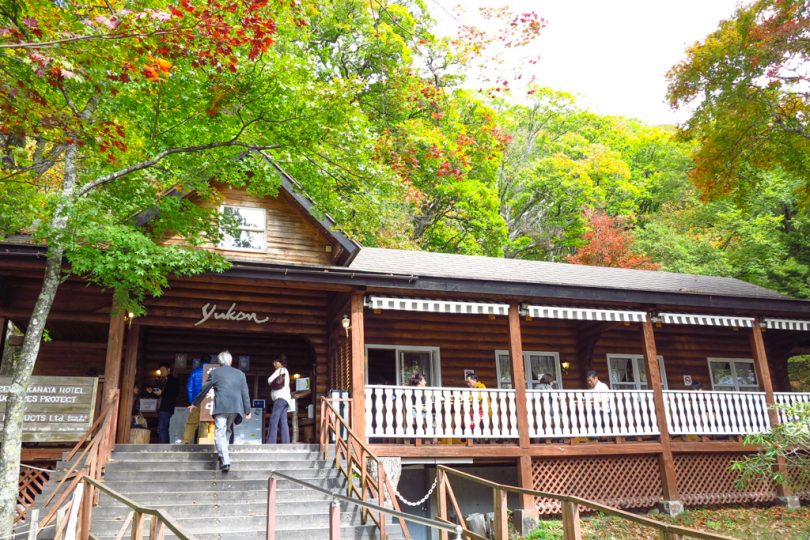
Hyakunen Rice Curry, which was featured in the bicycle manga “Long Riders!” is a traditional curry that recreates a recipe invented in the Taisho era (about 100 years ago).

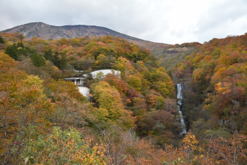
Dynamic Ryutou Falls
Stop by Ryutou Falls near Coffee House Yukon.
The waterfall seen from the terrace of Ryuzu-no Teahouse is a spot often used for TV broadcasts.
You are welcome to use the terrace while having tea at the teahouse or while shopping.
The view of the Yugawa River from Ryuzu-no-bashi Bridge, which is located behind the teahouse on National Route 120, is also recommended.
Take the city road leading to Chitegahama Beach
Continue on Route 120 and enter the road with the gate closed on the left before Akanuma Tea House.
Nikko City Route 1002 leading to Senjugahama Beach is closed to general vehicles for nature conservation purposes, but is open to “pedestrians, bicycles, and low-pollution buses”. The gate has a warning for bicycles, so be sure to read it carefully before entering.
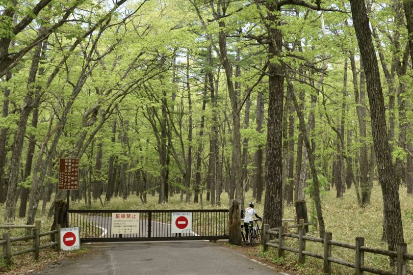
Next to the gate, there is enough space for pedestrians and bicycles to pass through.
Once you enter the city road, you will find a quiet atmosphere without the noise of cars like when you were driving on the national highway.
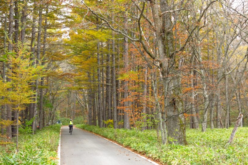
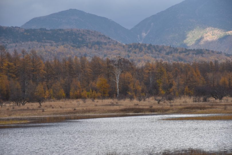
After driving carefully watching out for the occasional low-pollution bus, you will arrive at Odashirogahara.
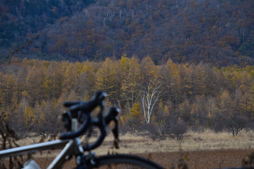
In the marshland of about 2km in circumference, an eye-catching white birch tree, commonly known as “the lady,” is famous among photographers. The white tree in the distance certainly stands out.
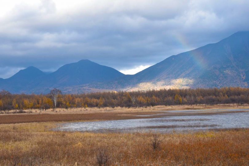
Phantom Lake Odashiro
Just before the day we went there, heavy rains had continued, and a phantom lake had appeared in the marshland.
“Lake Odashiro” has appeared only three times in the past 10 years.
We would be lucky if the lake was spreading when we visited.
As we were taking pictures, light shone through a gap in the clouds and a rainbow appeared! It was an indescribably divine view.
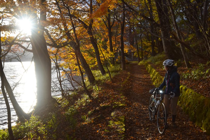
After passing Odashirogahara, it is basically a downhill road to Senjugahama beach.
Since there are no cars or motorcycles on the road, you can sometimes hear the cries of deer coming from the quiet forest.
Senjugahama Beach is located at the end of the city road.
In June, Primula japonica is in bloom and the colors are vibrant. In autumn, you can enjoy the autumn leaves from the lakeside.
The autumn days are short, so go back the way you came.
When you return to the national highway and head toward Lake Chuzenji, you can see Lake Chuzenji just as the sun is shining, and it is beautiful.
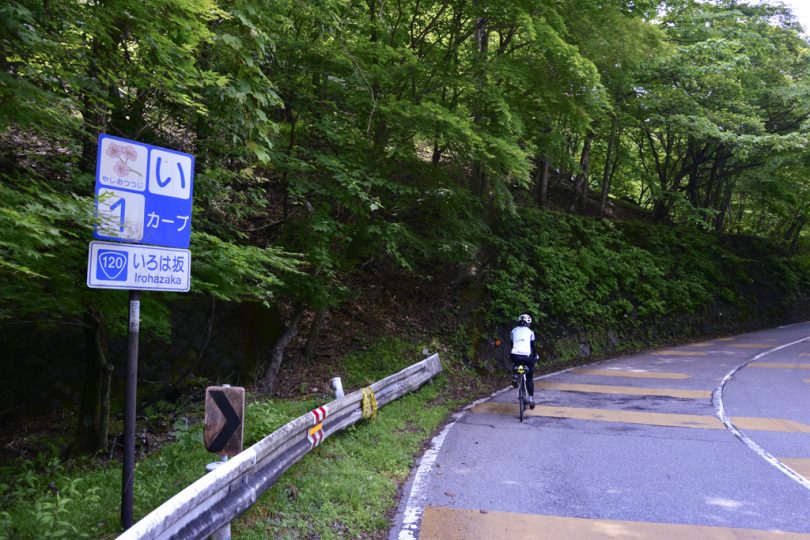
Back at First Iroha-zaka
The sunset was beautiful, so we pushed our bicycles to Lake Chuzenji promenade.
We would have liked to take a leisurely stroll, but it would have been dark after sunset, so it was time to go back down the hill.
We entered the first Iroha-zaka, which is a descent-only slope, and descended carefully.
There are many tight curves, and my hands are numb from squeezing the brakes.
We take a break at the “Nikko Iroha-zaka Kenkagamine Viewing Spot” on the way down the slope, which has a series of 99 curves.
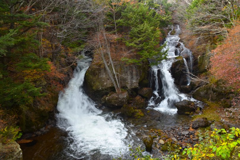
We were told that two waterfalls can be seen from here, but I could see one well, but the other was only faintly visible.
Once you reach the Iroha-zaka Horseback Ride parking lot, you can continue down Route 120 to the parking lot to finish.
Course Introduction
Access
Train: Asakusa Station – Tobu Nikko Station (about 1 hour and 50 minutes) Shinjuku Station – Tobu Nikko Station (about 2 hours)
Car: Tohoku Expressway “Utsunomiya Interchange” to Nikko Utsunomiya Road “Kiyotaki Interchange”
▼ Coffee House Yukon
https://www.kanayahotel.co.jp/eng/ckh/
Summary
Looking at the distance alone, it is 71km, but half of it is downhill and the scenery is great, so we would encourage you to try your best to go up. However, there are many cars and motorcycles during the fall foliage season, so it may be best if you can go on a weekday.